This is a particular village 30 Kms upstream Saragosse along the Ebro river, Google-Map, where we can observe a riverine island with its typical confluence pattern, and our computer LSPIV video processing:
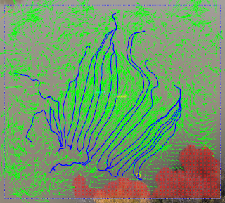
What´s beneath the following flow pattern ? Drone zenithal view subsequently vectorized with LSPIV. You´ve got it; just this groyne when submerged flow begins !
Tests at Castejon de Ebro: Checking heights for look angles, fields of view and resulting flow resolution around Castejon railway bridge, during the dry season . This is a key reach for monitoring the Ebro river during flood periods.
A rather complex process, which can lead to spectacular images of mixing eddies. Practical questions like: what´s the mixing length, the influence of each stream speed and width, and how do they change along the interface, can be derived for simple cases with math models.




Comments
Post a Comment