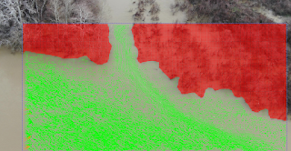
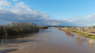
Tests at Castejon de Ebro: Checking heights for look angles, fields of view and resulting flow resolution around Castejon railway bridge, during the dry season . This is a key reach for monitoring the Ebro river during flood periods.
State of the art technique is available at this IAHR publication: https://iahr.org/Portal/News/News%20-%20Latest%20issue%20of%20Hydrolink%20on%20Drone%20Special%20is%20now%20published.aspx
4K images dozen of meters above water surface allow for tracking the flow speed in this confluence, the change in velocity determines the driving forces (Newton´s 2nd Law) and the prediction of effects and control measurements. Drone videos and further image processing are affordable tools for real scale studies.
Limitations, accuracy, Ground Control Points support, Structure from Motion, what can be done at the moment ? Latest research available at: https://www.mdpi.com/journal/drones/special_issues/DroTop
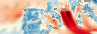
Testing a DJI Mavic 2 Zoom to feel familiar with stable heights, angles and video parameters, although January is usually windy at Saragosse and wind speeds over 10 m/s are not secure, as happens now; current wind speed map provided by darksky.net .